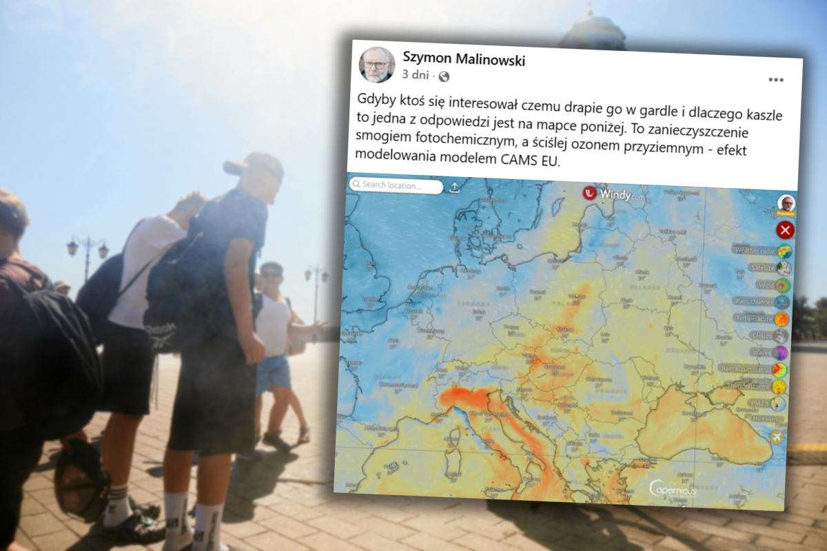


Poland will be swept by cooler polar‑oceanic air moving in from the west, causing temperatures to plummet in the coming days and bringing an increased chance of rain and storms.
Cooling in the Coming Days
Synoptic meteorologist from the Institute of Meteorology and Water Management, Tomasz Siemieniuk, told the Polish Press Agency that cooler polar‑oceanic air is beginning to flow into our country. This means a significant change in weather after the recent hot week. Forecasts show that it will bring light, short‑lived showers and storms, primarily over the north and east of the country. In the coming days we may also feel a drop in temperature.
Monday Forecast
According to the Institute of Meteorology and Water Management, on Monday, August 18, most of the country will have light to moderate cloud cover. Only in the Pomerania region one can expect somewhat more sunshine. Maximum temperature will hover around 23–26 °C, with the warmest conditions in the northwest. Slightly lower temperatures are expected in the mountain basins, ranging from 21 to 22 °C. Winds will be weak, from the southwest and west, while the south will experience variable wind but generally southward.
A Shift in the Coming Week
The 10‑day forecast indicates that by the middle of next week temperatures will rise again. On Tuesday, August 19, residents of southern Poland will feel noticeable warming, with thermometers reaching around 24–27 °C. Wednesday will be even warmer, with temperatures reaching up to 28 °C in southern provinces. However, by Thursday, August 21, Poland will be affected by an atmospheric front that, as the *Your Weather* service reports, could bring heavy rain and occasional hailstorms. IMGW predicts up to 40 mm of rainfall in Lesser Poland that day, and up to 20 mm in the mountains.