


A powerful earthquake has claimed at least 19 lives and left over 130 injured in the Philippines, causing widespread structural damage, landslides, and temporary transport disruptions across the Mindanao region.
Casualties and Devastation
Several hours after the earthquake, civil defense authorities confirmed at least 19 fatalities and over 130 injuries. Local radio reports indicate that most deaths were caused by landslides in the Glan region of Sarangani province, with seven people currently reported missing.
The tremor struck at 7:37 a.m. local time, with its epicenter located at sea, approximately 13 km southwest of General Santos. The city, home to over 700,000 residents, serves as a major trade and tuna processing hub on Mindanao Island.
Infrastructure and Tsunami Alert
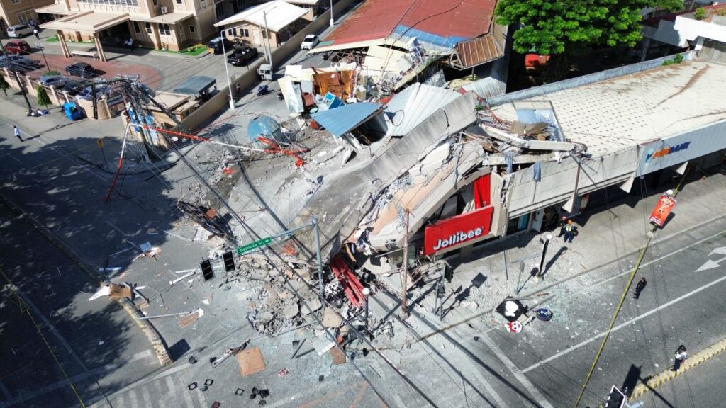
The quake caused smaller commercial buildings to collapse and damaged a bridge. Due to extensive damage, civil aviation authorities temporarily closed the city’s international airport, resulting in the cancellation of several domestic flights.
The Pacific Tsunami Warning Center announced that the threat of destructive waves had passed after approximately five hours. Earlier, water surges reaching one meter in height were recorded on the coasts of several provinces; tsunami alerts have since been lifted for both the Philippines and Indonesia.
Geological Context and History
Benjie Ancheta, the police chief of nearby Alabel, described the event as the strongest earthquake they have ever experienced, noting visible cracks in the local police station. The Philippines and Indonesia are situated along the Pacific Ring of Fire, a zone where approximately 90 percent of the world’s earthquakes occur due to frequent volcanic and tectonic activity.
The country’s last major seismic disaster occurred on September 30 of last year, when a 6.9 magnitude earthquake in the Cebu province resulted in at least 72 deaths and 500 injuries.