


Poland faces widespread freezing rain since February 5, with IMGW warning of dangerous black ice, especially in the west and center.
Freezing Rain Sweeps West and Center
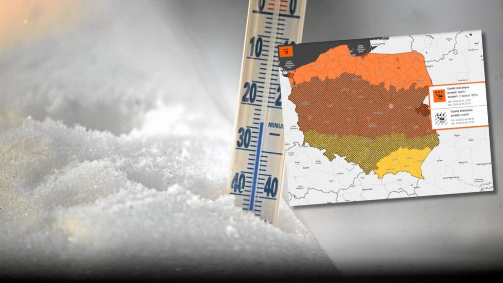
Since the night hours of February 5, a vast zone of precipitation associated with a slowly moving atmospheric front has been moving over Poland. The most active part of the system stretches from Szczecin Lowland, through Lubusz and Wielkopolska, to Kuyavia, central Poland, and Masovia. Precipitation varies by region: snow in Łódź, rain with snow in Poznań, and freezing rain causing dangerous black ice in Warsaw due to sub-zero temperatures. This type of precipitation poses the greatest threat today.
North and Northwest Face Worst Conditions
Particularly difficult conditions are forecast for Pomerania, Warmia, Kuyavia, and much of Wielkopolska and Lubusz. In these regions, precipitation may intensify at times and take the form of a mixture from wet snow to snow with rain to freezing rain. Forecasters warn that roads and pavements will quickly become covered with ice. Walking will become dangerous, and drivers should expect extended travel times and local traffic disruptions.
South Experiencing Thawing Temperatures
The situation in southern Poland looks slightly better. A thaw is progressing in Silesia, Małopolska, and Subcarpathia. In Zakopane, morning temperatures reached up to 7°C, significantly reducing the risk of black ice. However, this does not mean complete safety. At night, especially in low-lying areas, slippery surfaces may still occur, though on a much smaller scale than in the rest of the country.
IMGW Warnings Issued Nationwide
From February 4, residents of all regions may receive RCB alerts regarding difficult conditions. The Institute of Meteorology and Water Management has also issued warnings nationwide. Additionally, except for the south, these are second-level warnings. “Freezing rain or drizzle causing black ice will persist for a significant part of the day. Roads and pavements will be slippery!” warns IMGW.
Improvement Expected by Weekend
According to forecasts, freezing precipitation in many regions will continue at least until the night from Thursday to Friday (February 6). The problem will last longest in the north and northeast, where precipitation will gradually weaken. A marked improvement in weather conditions is expected only in the weekend. As colder air arrives, rain will turn to snow, and freezing precipitation will completely cease. Until then, authorities are urging caution and adjusting speed to road conditions.