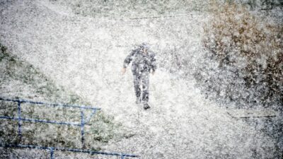
Poland’s meteorological institute IMGW has issued a warning of heavy snow, forecasting up to 20 cm of accumulation across many regions and urging residents to prepare.
Forecast for the coming days
Over the next few days the approaching Genoa trough will bring intense snow and rain across most of Poland.
According to IMGW forecaster Agnieszka Prasek, Tuesday will see rain in the centre and east, along with mixed precipitation of snow and rain that may freeze in places.
Localised heavy snow may also fall on the southwest, with temperatures ranging from 0 °C to 2 °C, while the south‑east and coast stay up to 5 °C.
From Tuesday night through Wednesday night, heavier snowfall is expected from the south‑west through to the north‑east, adding approximately 15–20 cm of snow cover.
Wednesday will continue to see heavy rain, rain with snow, and sleet across the same belt, again adding about 15–20 cm.
Daytime temperatures are forecast at 0–2 °C, increasing to 6 °C in the south‑east and coast.
Thursday will be generally clear in the west, but snow, rain with snow and rain will fall east, centre, south and along the coast.
By the end of the week, nights may drop to –8 °C, while daytime temperatures remain warm, up to 6 °C.
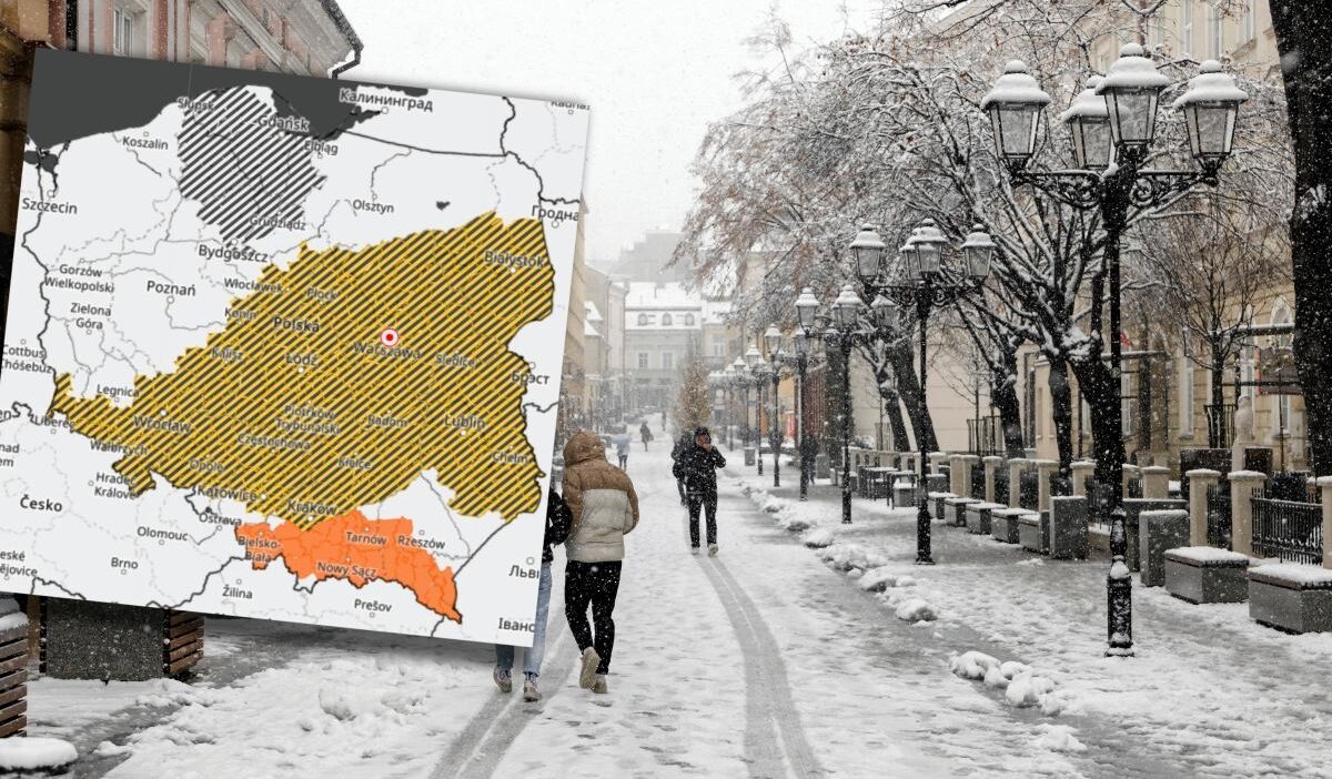
First‑Level Alerts
IMGW forecasters have issued first‑level alerts for cold, dangerous precipitation in the following divisions: Masovian; Lower Silesian (except Bolesławiec and Legnica counties); Opole (except Głubczyce County); Lesser Poland (except counties where second‑level alerts apply); Świętokrzyskie; Silesian (north counties); Lesser Poland (Kazimierza, Kraków, Chrzanów, Miechów, Olkusz counties); Lublin; Podlaskie (except northern counties); Kuyavian‑Pomeranian (Rypin, Lipno, Włocławek, Aleksandrów, Radziejów counties); Łódź; and Greater Poland (Miłaków, Krotoszy, Ostrołęka, Kępa, Koni…).
These alerts remain in force until Wednesday 07:30. They warn that intermittent light rain, rain with snow or drizzle may freeze, leading to ice or sleet.
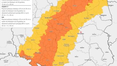
Second‑Level Alerts
Second‑level alerts for potential thawing are active in the following areas: Podkarpackie (Bieszczady, Lesko, Sanok, Brzozów, Krosno, Strzyżów, Jasło, Dębica, Ropczyce‑Sędziszów) and Lesser Poland (Gorlice, Tarnów, Nowy Sącz, Tarnów, Nowotarski, Susko, Wadowice, Myslowice, Wieliczka, Brzesko, Bocheń, Limanow). Also Silesian (Zywiec, Cieszyn, Bielsko‑Biała).
These alerts are in place until Wednesday 18:00 and warn of possible temperature rises, wetting rains, and snow cover melting. Minimum temperatures will be 1–4 °C, maximum 3–6 °C, with total precipitation possibly reaching 15 mm.