Polish meteorologists have issued first‑degree fog alerts across most of the country, warning that dense fog could reduce visibility to below 200 m from Sunday evening until Monday morning.
Fog Alerts
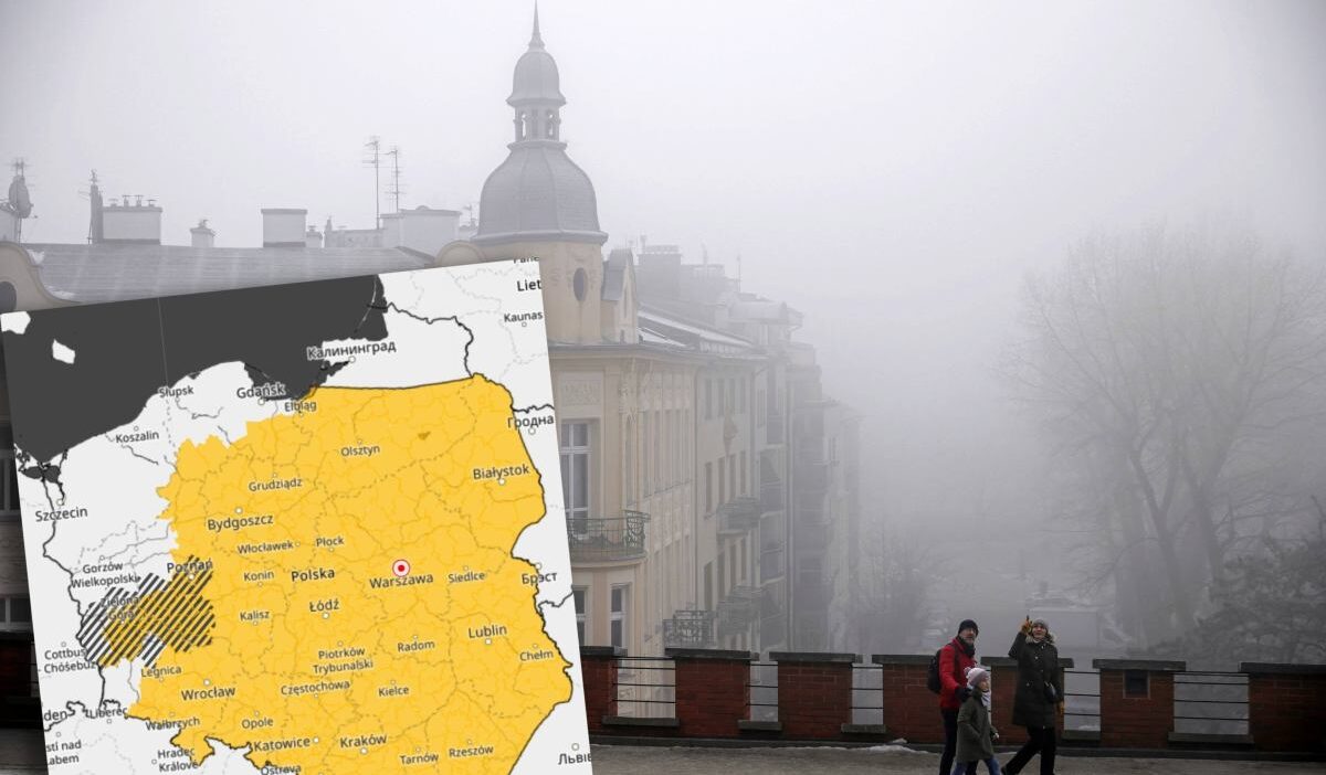
Polish Institute of Meteorology and Water Management (IMGW) has issued first‑degree fog warnings for most voivodeships. The alerts will run from 5 p.m. Sunday to 9 a.m. Monday.
Forecasters say visibility may fall below 200 m in some localities. Fog will locally deposit drizzle, making roads and trails slick.
Alerts do not apply in the northern and central parts of Pomeranian Voivodeship, the entire West Pomeranian Voivodeship, the northern counties of Lubuskie, and the western part of Lower Silesian Voivodeship.
Weather for the Next Days
On Monday, most of the country will be overcast, with clearings only expected in the south and west. Rain and drizzle will fall in the north and centre.
Maximum temperatures will range from 0 °C in the north to 4 °C in the west and 5 °C in the southeastern mid‑day. Winds will be weak, moderate‑variable in the northwest, occasional sea‑level strong gusts, and south‑east and south winds.
Tuesday and Wednesday will see similar conditions: widespread cloudiness with rain in the NNE and centre, and local fog reducing visibility to 200 m. Temperatures will max at 2 °C in Podhale and the north, 5 °C in the south, and 6 °C in the south‑east.
By the end of the week weather is expected to remain similar, with no sudden return of heat, so further snowfalls and a drop in temperature are likely only by the following week.
What Will the Next Winter Look Like?
Spokeswoman Agnieszka Prasek said that a recent late‑November heat surge enhances the chance of cold air entering Poland in December and January.
She noted that snowfall prospects look good, especially in the south, centre and east, and that sufficiently low temperatures could keep a permanent snow blanket. A European high‑pressure system will steer cold Arctic air from the east and NNE. January and February scenarios may involve a polar vortex rebuild, potentially sparing a milder winter.
Prasek added that long‑term models predict a warmer winter than this year and that forecasts carry large uncertainty.