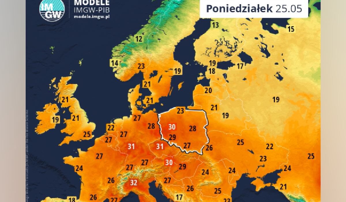
Poland is set for a significant temperature spike starting May 19, with meteorologists from IMGW forecasting regional heatwaves that could reach 32°C by May 25, alongside variable spring weather patterns.
Temperature trends and regional outlook
Starting Tuesday, May 19, temperatures will begin to climb across Poland. While the west of the country will see levels around 22°C, the mercury is expected to rise further throughout the week, peaking on Monday, May 25, when western regions may reach up to 32°C.
Forecast for the week of May 18-24
IMGW reports a diverse weather week ahead. The start of the week will be cloudy and rainy in many areas, though the south and west will see sunshine. Light winds may lead to morning fog in some regions.
The second half of the week should bring more sun, but clouds and intermittent rain showers are expected. By the end of the week, rainfall may intensify, and local thunderstorms cannot be ruled out.
Detailed outlook for Tuesday and Wednesday
On Tuesday, IMGW predicts moderate to thick cloud cover with afternoon rain in the southwest and localized storms in the northeast, where rainfall could reach 20-30 mm. Maximum temperatures will range from 12°C on the coast to 21°C in the east. Winds will be light, though gusts up to 55 km/h are possible during storms.
Tuesday night will be mostly clear to moderately cloudy with some rain in the north and east, and potential fog in the west and south. Overnight lows will vary from 2°C in mountain basins to 12°C in the east.
Wednesday will start clear, with cloud cover and rain showers developing in the west and center by afternoon. Possible thunderstorms may bring up to 15 mm of rain. Daytime temperatures will reach between 16°C in the mountains and 23°C in Polesie, with storm gusts reaching 60 km/h.