






Cold Start to the Week in Poland as Temperatures Plunge to 3 Degrees Locally
Cool maritime polar air flowing into Poland brings mixed weather conditions for Monday and Tuesday, featuring localized storms, strong winds, and night temperatures dropping down to 3 degrees...
Cool maritime polar air flowing into Poland brings mixed weather conditions for Monday and Tuesday, featuring localized storms, strong winds, and night temperatures dropping down to 3 degrees Celsius.
Table Of Content
Cold Polar Air Flowing Into Poland
Cool maritime polar air is flowing into Poland from the northwest. At the same time, the north of the country remains under the influence of a low-pressure system from the Gulf of Finland, while a high-pressure ridge associated with a high over the British Isles builds over the rest of the country. As a result, residents of Poland face varied atmospheric conditions, with precipitation and storms in parts of the country and a cool night.
Monday Forecast Bring Rain, Storms and Strong Winds
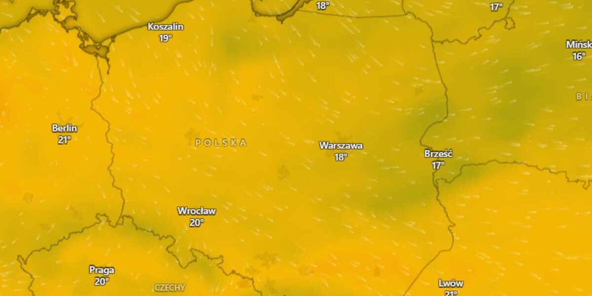
According to the forecast by the Institute of Meteorology and Water Management, the best weather on Monday is expected in the south and southwest, where the sky will be clear or only partially covered with clouds. In other regions, cloud cover will increase periodically, and occasional rain will occur in places. Storms are locally forecasted in the north and northeast, during which wind gusts may reach 65 km/h, and storms may be accompanied by more intense precipitation with a forecasted rainfall total locally from 10 to 15 mm. Outside storm areas, the wind will be light and moderate from the west and northwest.
Daytime Temperatures and Chilly Night Ahead
Monday will not bring high temperatures, as the northeast will see maximums around 18 degrees Celsius, while the western and southern parts of the country will be warmer with highest values ranging from 22 to 23 degrees. The night from Monday to Tuesday will be mostly clear with few clouds, though cloud cover will periodically increase in the north with occasional rain in places. Temperatures in Carpathian mountain basins may drop locally down to 3 degrees Celsius, while minimum values in other regions will range from 8 degrees in the south to 13 degrees in the northwest, and about 14 degrees by the coast.
Foggy Conditions and Tuesday Weather Shift
Fog may form in the north, west, and center of the country, reducing visibility locally to just 300 meters with generally light and variable winds, though blowing stronger high in the Carpathians with gusts up to 55 km/h. Tuesday’s weather will bring a change as temperatures rise to 24 degrees, with mostly small to moderate cloud cover. More clouds will appear in the northeast and far southern and southwestern extremities, where occasional precipitation and storms in the first mentioned region are possible. Maximum temperatures on Tuesday will range from 19 degrees Celsius in the northeast to 24 degrees in the west and south, while foothill areas will locally see about 18 degrees with generally light winds, and moderate to gusty winds from the east in the south and southwest, and northern directions in the northeast.