The Polish Institute of Meteorology and Water Management warned on the night of 25 November that widespread heavy snow and freezing rain will affect large parts of the country, threatening roads and power supply through the next days.
Snow Returns to Many Regions
The first precipitation will appear on the evening of 25 November. Rain will fall in the south, while central and northeastern areas will receive snow transitioning to rain with snow grains, with some places experiencing freezing rain and forming ice scales. Local totals could reach 3 cm of snow, up to 10 cm in the Tatra mountains.
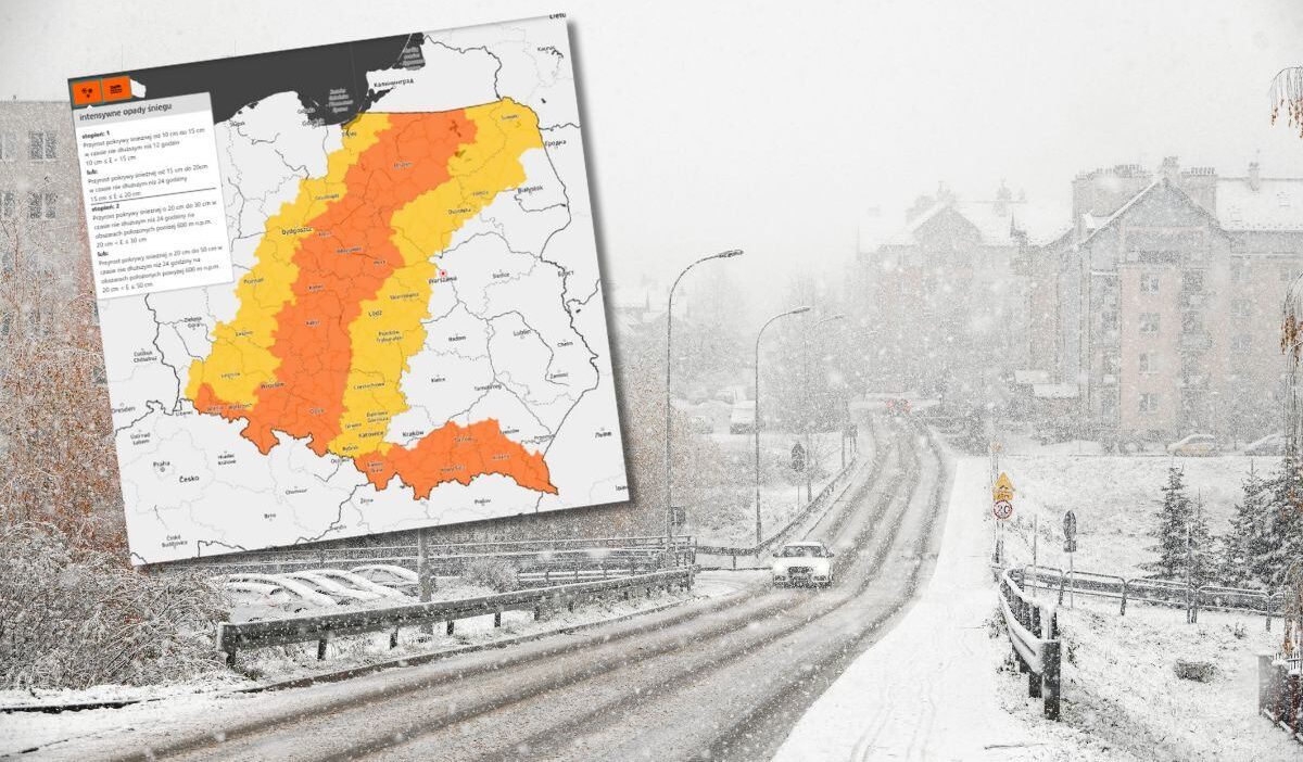
The forecasts also predict intense snowfall from Lower Silesia to Podlasie, ranging from 8 to 10 cm of white cover, and up to 20 cm in the Carpathians. Visibility may drop to 200 m during the storms, and temperatures between ‑2 °C and 1 °C will keep snow on the roads. First‑ and second‑degree warnings have been issued.
Continued Snowfall Expected
On Wednesday and Thursday, snow will persist across a band from Silesia to Warmia and Masuria, also into foothill regions, with moderate intensity. Snow depth could increase by 10‑15 cm locally, while central Poland may see up to 13 cm.
Mountain winds could reach 100 km/h, producing blizzards and drifting snow. Freezing rain and ice scales may appear in the northeast. The warmest temperatures will be in the southeastern and lower eastern parts, reaching 9 °C, while the north and center anticipate near‑zero conditions. Road traffic will remain hazardous with limited visibility.
Podkarpacie Still Fights Snow Aftermath
Wojciech Czanerle, acting director of the Rzeszów Regional Crisis Management Centre, told PAP that, due to heavy snow, 5,500 customers remain without power. Earlier on Monday afternoon, 55,000 customers were without electricity, rising to 140,000 in the morning. On Tuesday, 20 schools stayed closed, and on Wednesday, 26 November, if any of those schools still lack power, generators will be activated.